

Overview
An experiment exploring Google Earth satellite images through gesture. Doodle to begin.
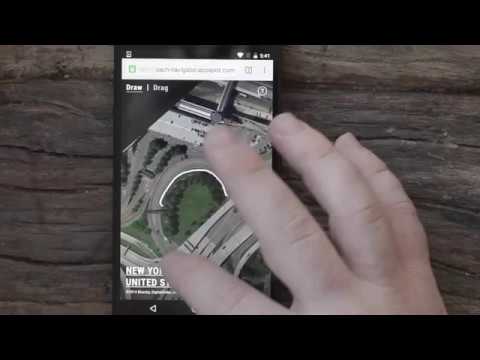
Satellite images provide a wealth of visual data from which we can visualize in interesting ways. Land Lines is an experiment that lets you explore Google Earth satellite imagery through gesture. “Draw” to find satellite images that match your every line; “Drag” to create an infinite line of connected rivers, highways and coastlines. Using a combination of machine learning, optimized algorithms, and graphics card power, the experiment is able to run efficiently on your phone’s web browser without a need for backend servers.
4.2 out of 510 ratings
Google doesn't verify reviews. Learn more about results and reviews.

bobby noOct 2, 2020
SO SATISFYING OMG PLEASE GET IF U HAVE ANXIE|TY

James TunnicliffAug 9, 2020
it sucks

Nicholas ConleySep 17, 2019
cool idea didn't really work for me
Details
- Version0.0.0.2
- UpdatedJanuary 4, 2017
- Size39.24KiB
- LanguagesEnglish
- Developer
- Non-traderThis developer has not identified itself as a trader. For consumers in the European Union, please note that consumer rights do not apply to contracts between you and this developer.